Area Maps
Interactive Map
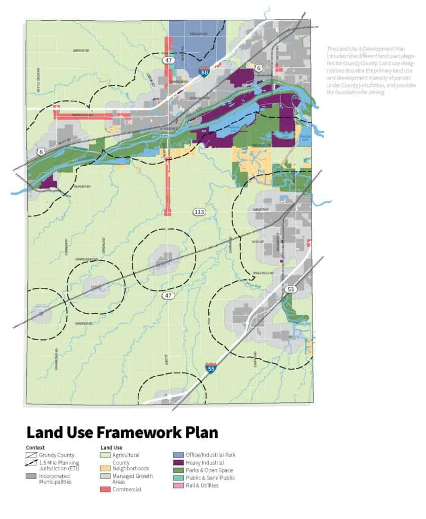
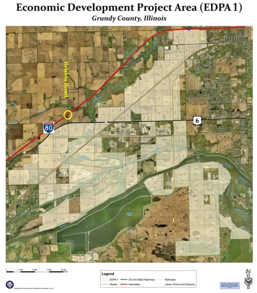
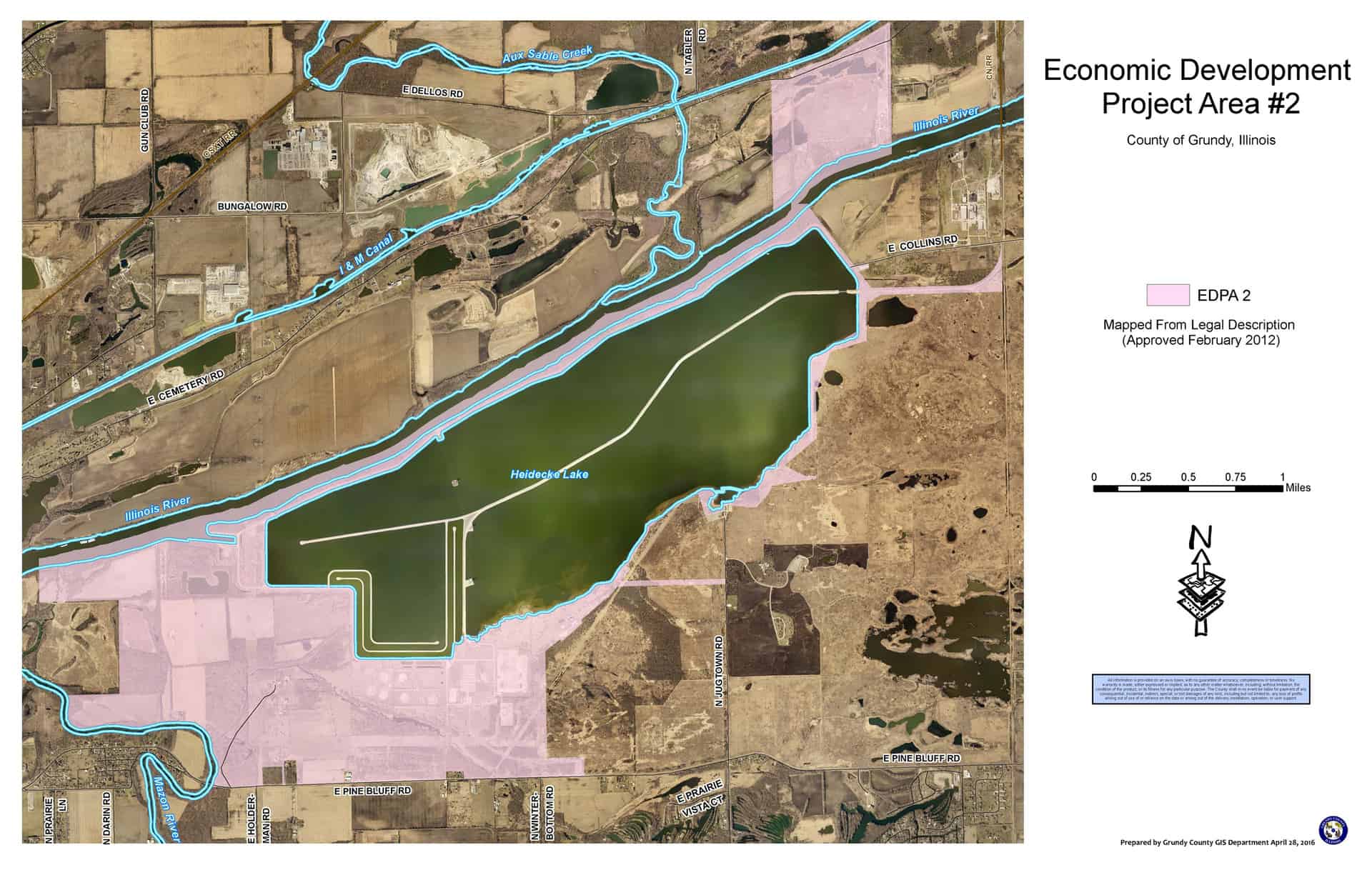
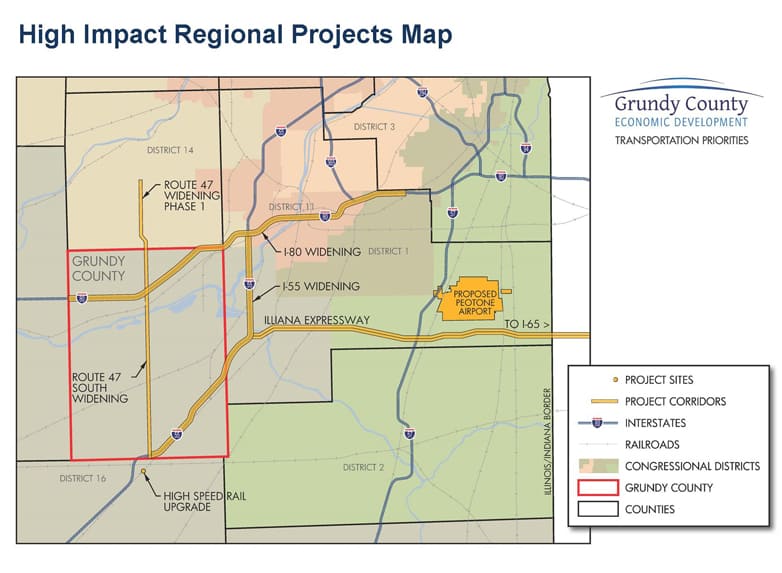
Get perspective on the county’s transportation network, land use plan and tax incentive districts by viewing the maps below.
Maps & Resources
Comprehensive Land Use
TIF Districts
TIF Districts
Enterprise Zones
Enterprise Zones
Grundy County has two enterprise zones and the benefits include:
- Sales Tax Deduction
- Investment Tax Credit
- Machinery & Equipment Sales Tax Exemption
- Utility Tax Exemption
- Gas Use Tax Exemption
Enterprise zones were developed by the State of Illinois to stimulate industrial growth and retention in regional areas. The two zones serving Grundy County were established in 2016. The zones are powerful tools designed to mitigate costs related to private investment and job creation.
GIS Map
Major Roadways
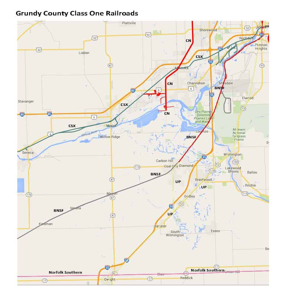
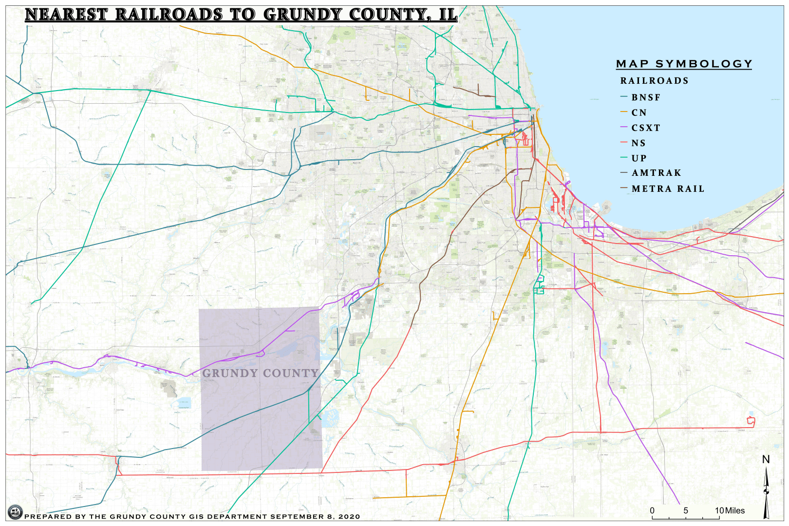
Railroads
Railroads
Freight Service
Passenger Service
Rivers
Rivers
Illinois River and Inland Ports
The Illinois River accounts for 273 miles of the 327 miles of the “Illinois Waterway” that connects Lake Michigan to the Mississippi River.
River Terminals
Name: Shipyard Terminal & Industrial Park, Inc.
Products Handled: Salt, Coal, Grain Products, Dry Fertilizer, Steel, Dry and Packaged Goods
Storage: Open – 100 acres; Covered Dry Bulk – 65,000 tons
Handling Facilities: Cranes to 100 tons; Bucket – 4 yd.; Inbound – 400 tph.; Outbound – 1,100 tph.
Barges Handled: 3 worked, 2 held handling facilities
Operations: 6 days a week, 10 hours a day
Connections: CSX; Switchboats available.
DRESDEN ISLAND LOCK & DAM
521 N Lock Rd.
Morris, IL 60450
Phone: 815/942-0840
Fax: 815/942-4217
Location:
River Mile 271.5
Illinois River
2 miles NW Dresden Nuclear Power Plant
Tonnage Locked through:
Annual Tonnage for 2017
16.3 million tons commodity including:
- 854 thousand tons of farm products
- 2.9 million tons of manufactured goods
- 4 million tons of Petroleum products
- 3 million tons of chemicals
SENECA REGIONAL PORT
The Seneca Port District offers cost efficient and safe handling of freight on the property.
Marine: Located in the Shipyard Industrial Park is L.S.T., a river terminal that has the ability and equipment to serve a variety of marine related needs which include the following:
- Crane lifting to 200 tons
- Bulk barge unloading to truck or rail at 250 ton an hour
- Barge loading from rail or truck at 800 ton an hour
- Rail to truck transfer equipment
- Unit train capacity
- 12000 linear feet of rail on the property
- 750 feet of concrete dock with two mooring cells
- 2 hydraulic cranes for unloading barges
- 7 various size front loaders
- 100,000 lb truck scale
- Heavy-Duty fork lifts
All major land barge carriers and major trucking companies are served by the Port District. CSX Rail Road serves tenants of the district.
Airports
Airports
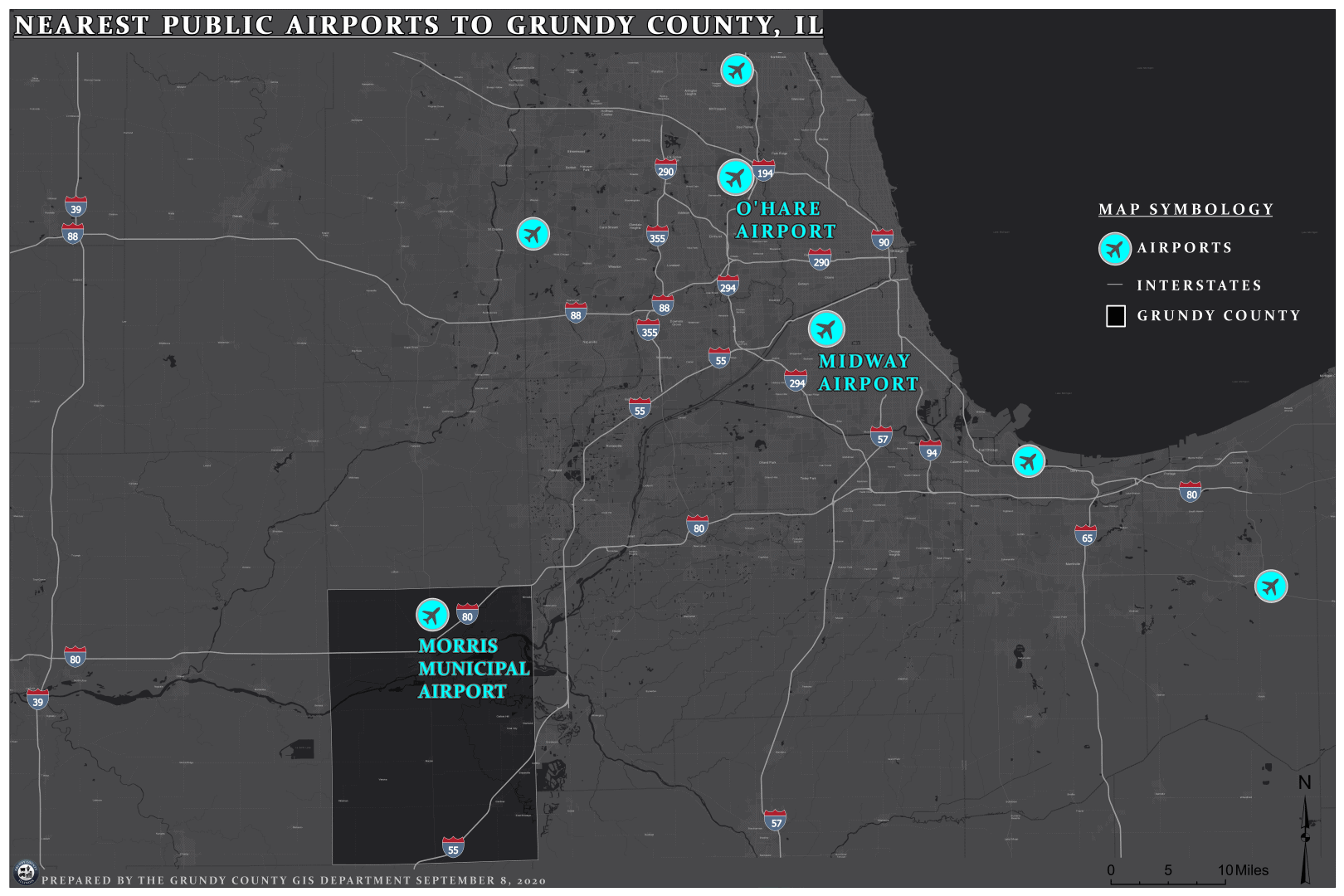
Nearest Public Airport
Morris Municipal – James R. Washburn Field Airport
- Nearest Road Access: I-80 and Route 47
- Surface: Asphalt
- Length of Runway: 5,500 ft. lighted
Nearest Commercial Airports
- Chicago — Midway Airport
- Chicago — O’Hare International Airport
- Bloomington/Normal — Central Illinois Regional Airport
- Morris — Morris Municipal Airport
Chicago’s airports are approximately 60 miles north of Grundy County.

